The Best Drone Apps for Enhancing Your Flight Experience
25 August 2025
Let’s be honest — drones are awesome. Whether you’re a casual weekend flyer, an aspiring aerial photographer, or a pro drone pilot who makes Spielberg-level cinematic masterpieces, having the right apps can take your drone game from “meh” to “whoa!”
There’s a whole sky full of drone apps out there — some guide you through weather patterns, others give you epic camera controls, and a few even help you dodge angry birds (not kidding). So, if you’re strapping in for flight, you're gonna want to pack a few digital co-pilots for the ride.
In this guide, I’ve rounded up the best drone apps for enhancing your flight experience — from planning and permissions to capturing jaw-dropping footage. Ready to level up? Let’s fly!
Why You Even Need Drone Apps (Yes, Seriously)
Think about your drone like a high-tech superhero. Now, imagine going into battle without your trusty sidekick. That’s what flying without drone apps is like.Apps can help you:
- Check for no-fly zones (because, um, jail isn’t fun)
- Track the weather (wind + drones = not friends)
- Plan your flight paths
- Get buttery smooth footage
- Control your drone like a pro gamer
So yeah, drone apps = must-haves.
1. AirMap – The Legal Eagle of the Skies
Available for: iOS & AndroidPrice: Free (with in-app purchases)
Let’s start with the grown-up stuff. Before you buzz your drone over the neighborhood, you need to make sure you’re good with local regulations. That’s where AirMap comes in.
AirMap is like that one friend who always reads the rulebook. It gives you:
- Real-time airspace maps
- Instant details on no-fly zones
- Worldwide airspace info
- Ability to file LAANC authorizations if you’re flying in controlled airspace in the U.S.
Need to contact an airport before launching? AirMap’s got your back.
🎯 Why It Rocks: It saves your butt from legal trouble and helps keep skies safe for everyone.
2. DroneDeploy – The Flight Planner Extraordinaire
Available for: iOS & AndroidPrice: Free to download; subscription options available
Planning a picture-perfect mission? Meet your new co-pilot, DroneDeploy. This app is all about mapping, automating, and analyzing your drone flights.
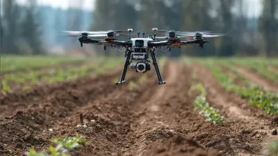
It’s mainly targeted at commercial use (think: agriculture, construction, inspections), but hobbyists who love precision will adore it too. It lets you:
- Design automated flight paths
- Capture consistent images for 3D mapping
- Access real-time data during flights
- Upload images for analysis
🎯 Why It Rocks: One word — automation. You set the plan, and your drone follows it like a pro GPS-guided ninja.
3. B4UFLY – FAA-Approved Sky Checker
Available for: iOS & AndroidPrice: Free
B4UFLY is the app equivalent of checking both ways before crossing the street. Backed by the FAA and powered by Aloft (formerly Kittyhawk), it helps you fly responsibly.
Fire up the app and get:
- Real-time info about airspace restrictions
- Interactive maps
- Nearby airports and heliports
- Clear indicators like “Good to go!” or “Don’t even think about it!”
🎯 Why It Rocks: Simple, user-friendly, and lets you fly with peace of mind.
4. UAV Forecast – Your Drone’s Weather Guru
Available for: iOS & AndroidPrice: Free (Pro version available)
Forget checking the weather app meant for joggers. You need meteorology built for flight. UAV Forecast is like having a weatherman who only cares about drones.
It shows:
- Wind speed and direction
- Temperature
- Precipitation
- Satellite visibility
- KP index (that’s how solar activity messes with your GPS)
Set your drone’s parameters (like max wind it can handle), and it’ll tell you when it’s safe to fly.
🎯 Why It Rocks: It prevents “oops” crashes and lost drones due to bad flying conditions.
5. Litchi – The Camera Wizard
Available for: iOS & Android (Paid App)Price: ~$24.99 (one-time purchase)
Want Hollywood-level shots without needing to be a drone pilot Jedi? Say hello to Litchi — the app that gives your drone creative superpowers.
It features:
- Advanced flight modes (orbit, follow me, waypoints)
- Virtual Reality Mode!
- Pre-programmed cinematic shots
- Smooth gimbal control
It supports many DJI drones and can even sync with VR headsets. You’ll feel like you’re inside the cockpit.
🎯 Why It Rocks: Killer shots with zero stress. It’s like putting your drone on autopilot while you play director.
6. DJI Fly App – DJI’s Swiss Army Knife
Available for: iOS & AndroidPrice: Free
If you own a DJI drone (Mini, Air, Mavic, anyone?), you probably already use this app — but do you know everything it can do?
DJI Fly combines:
- Firmware updates
- Flight logs
- Beginner tutorials
- Camera controls
- Live video previews
You’ll also get access to the "Fly Spots" feature to find cool places to fly nearby.
🎯 Why It Rocks: It’s essential for DJI users and surprisingly feature-rich for a free app.
7. Pix4Dcapture – For the Mapping Nerds
Available for: iOS & AndroidPrice: Free
Into creating stunning 2D maps and 3D models? Pix4Dcapture turns your drone into a flying data collector. Perfect if you’re into surveying land or just geek out over geospatial data.
Key features:
- Autonomous flight planning
- Multiple mission types (grid, double grid, circular)
- Compatible with tons of DJI drones
- Pairs well with Pix4D Mapper for processing
🎯 Why It Rocks: For those who love maps more than selfies.
8. Sun Surveyor – Because Light Is Everything
Available for: iOS & AndroidPrice: ~$9.99 (worth every cent)
Serious photographers and videographers know: light is everything. Sun Surveyor is a sun-tracking wizard that tells you exactly where the sun will be at any given time — and that means perfect golden hour shots every time.
Features:
- Augmented reality view of the sun and moon paths
- Light simulation for planning
- 3D compass for orientation
- Works offline!
🎯 Why It Rocks: Helps you plan your shots like a photography sniper.
9. SkyWatch.AI – Drone Insurance, But Make It Easy
Available for: iOS & AndroidPrice: Free (Pay only when you activate a plan)
Accidents happen — and replacing a drone isn’t exactly pocket change. SkyWatch.AI offers on-demand drone insurance that you can activate per flight.
- Covers liability and damage
- Real-time quotes
- FAA-compliant
- Monthly and pay-per-flight options
🎯 Why It Rocks: Peace of mind in the palm of your hand. Just swipe, insure, and fly.
10. LumaFusion – Edit Your Footage Like a Pro
Available for: iOS (iPad & iPhone)Price: ~$29.99 (One-time)
Okay, this one’s not exactly a “flight” app, but editing is half the battle. Want to turn your aerial clips into an epic montage? LumaFusion is like Final Cut Pro for mobile.
You get:
- Multi-track editing
- Color correction
- Transitions and effects
- Built-in royalty-free music
🎯 Why It Rocks: You can edit your footage on the go, even while waiting for your drone to charge back up.
Bonus App: Google Earth
Yup. Good ol’ Google Earth.It’s not built just for drones, BUT it’s one of the best tools to scout stunning locations before you even leave the couch. Look for landscapes, check altitude, plan your shots.
🎯 Why It Rocks: Scouting remote locations without leaving your blanket burrito.
Pro Tips for Picking the Right Drone Apps
Not all apps are for everyone, and that’s okay! Here are a few quickie tips to find your perfect app match:- Define your flying style. Casual flyer? Cinematic pro? Survey nerd? Pick accordingly.
- Stick to trusted devs. Especially when giving control of your drone.
- Check compatibility. Not all apps support all drones, especially with DJI’s models.
- Beware of battery hogs. Some apps are as power-hungry as your drone itself.
Final Thoughts: Fly Smarter, Not Harder
There’s no denying it — drones are high-tech marvels. But with great tech comes great responsibility (yes, I just Spider-Man quoted). With the right drone apps in your toolkit, you can fly safer, capture cooler footage, and blow your friends' minds when you upload that sick mountain flyover to Instagram.So gear up, download a few of these apps, and go make the sky your playground. Just promise me you’ll avoid flying into power lines, okay?
all images in this post were generated using AI tools
Category:
DronesAuthor:

Adeline Taylor
Discussion
rate this article
2 comments
Alanna Jennings
Unlock hidden skies; these apps reveal the unseen adventures.
March 13, 2026 at 1:13 PM
Margaret Collins
Great insights, thank you!
September 10, 2025 at 10:33 AM
Adeline Taylor
Thank you! I'm glad you found it helpful!