Myrtle Beach Leverages Drone Technology for Flood Simulation
September 11, 2025 - 02:50
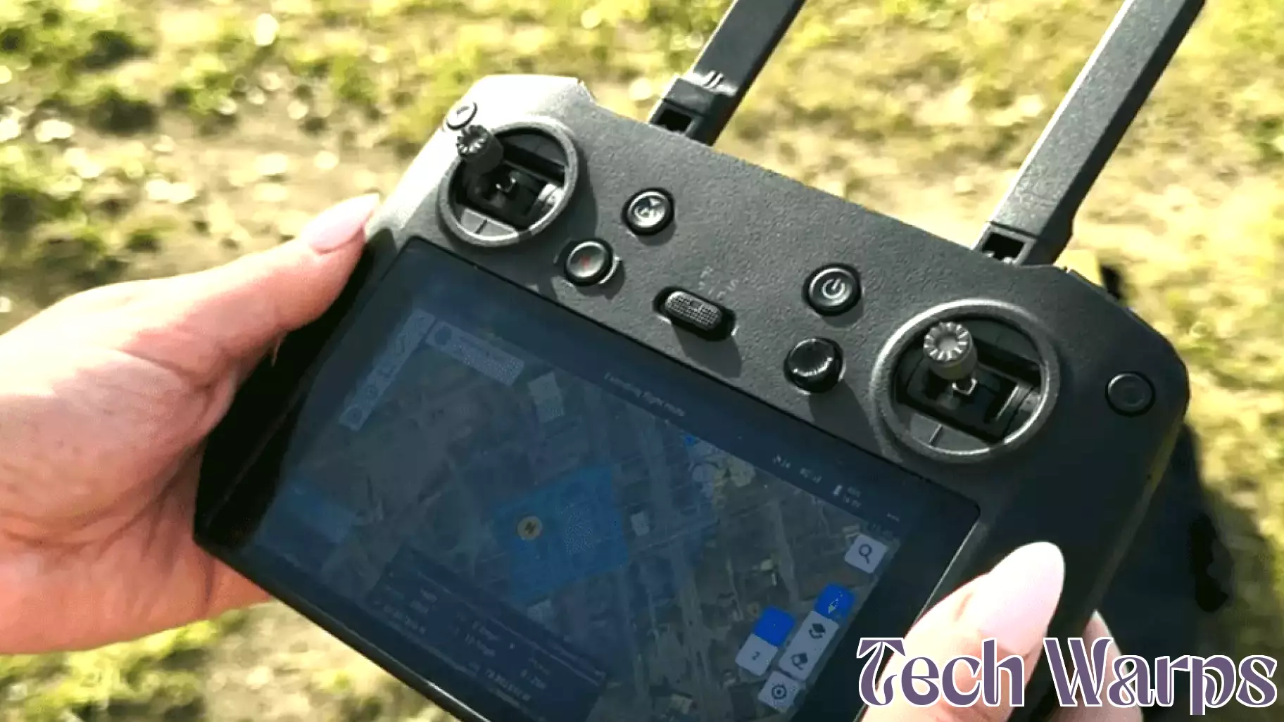
The City of Myrtle Beach's Information Technology Department is harnessing the power of drones and advanced software to simulate potential flooding scenarios caused by severe weather events. This innovative approach aims to enhance the city's preparedness for natural disasters by providing valuable insights into how different areas may be affected by flooding.
By deploying drones equipped with cutting-edge technology, city officials can gather real-time data and create detailed models of potential flood impacts. This proactive strategy allows for better planning and resource allocation, ensuring that emergency services are ready to respond effectively when a storm approaches.
The simulations not only help in understanding the physical impacts of flooding but also aid in community awareness and education. Residents can gain insights into flood risks in their neighborhoods, leading to informed decision-making and increased safety measures.
As climate change continues to pose challenges, Myrtle Beach's initiative exemplifies how technology can play a crucial role in disaster preparedness and resilience.
MORE NEWS

August 1, 2026 - 12:56
2s.design’s horse inhalation mask merges veterinary technology with natural form languageVeterinary equipment often looks like it was borrowed from a human hospital, but a new design called Equihero takes a different path. It is an anatomical inhalation mask made specifically for...
July 31, 2026 - 18:40
NC Made: Raleigh company helps families unplug and reconnect through creativityA Raleigh-based business is carving out a niche in the crowded toy and hobby market by focusing on something simple: getting families to put down their screens and make things together. The...

July 31, 2026 - 08:56
The Convergence Revolution — When AI Meets Every Emerging TechnologyArtificial intelligence rarely works in a vacuum. Its most transformative power comes from the point where it collides with other fast-moving fields. The current buzzword is convergence, and it is...

July 30, 2026 - 21:17
Spreading sunlight boosts algae productivity sixfoldResearchers at Michigan State University have found a way to dramatically increase how much algae can be grown outdoors. They developed a system that uses fiber-optic principles to spread sunlight...